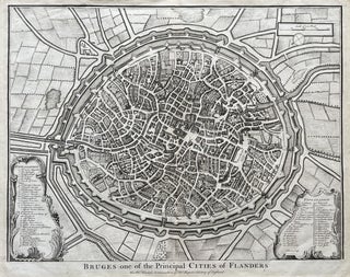
Bruges Original Copper-Engraved Map (1740)
A detailed 18th-century map providing a bird's-eye view of the fortified city of Bruges, located in northwestern Belgium. Keyed with an extensive list of notable buildings and landmarks, the map offers a glimpse into the workings of a city that, during the Middle Ages, was an economic powerhouse and one of Europe's principal commercial centers.
The subtitle, "For Mr. Tindal's Continuation of Mr. Rapin's History of England," identifies the map as one of a series of supplementary engravings produced for Nicolas Tindal's 18th-century historical work, The Continuation of Mr.....
Item #2137