
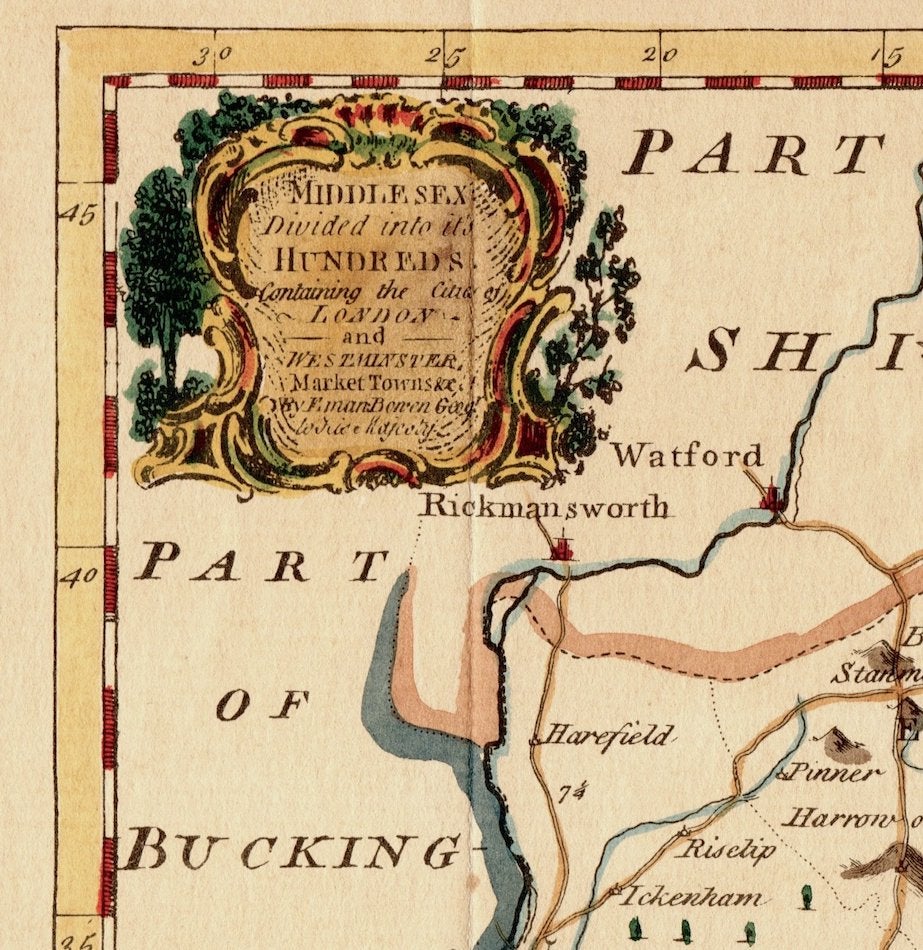
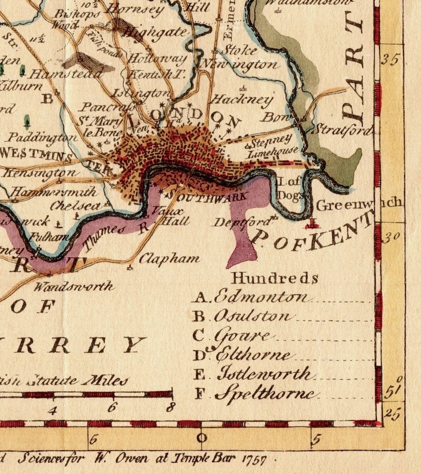
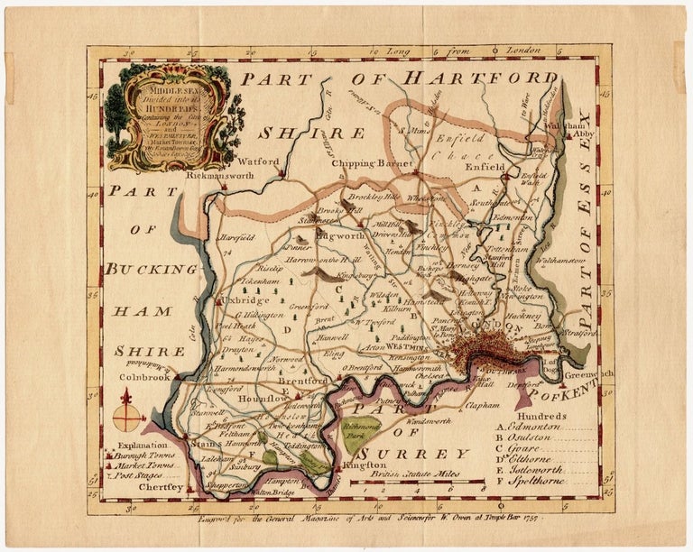
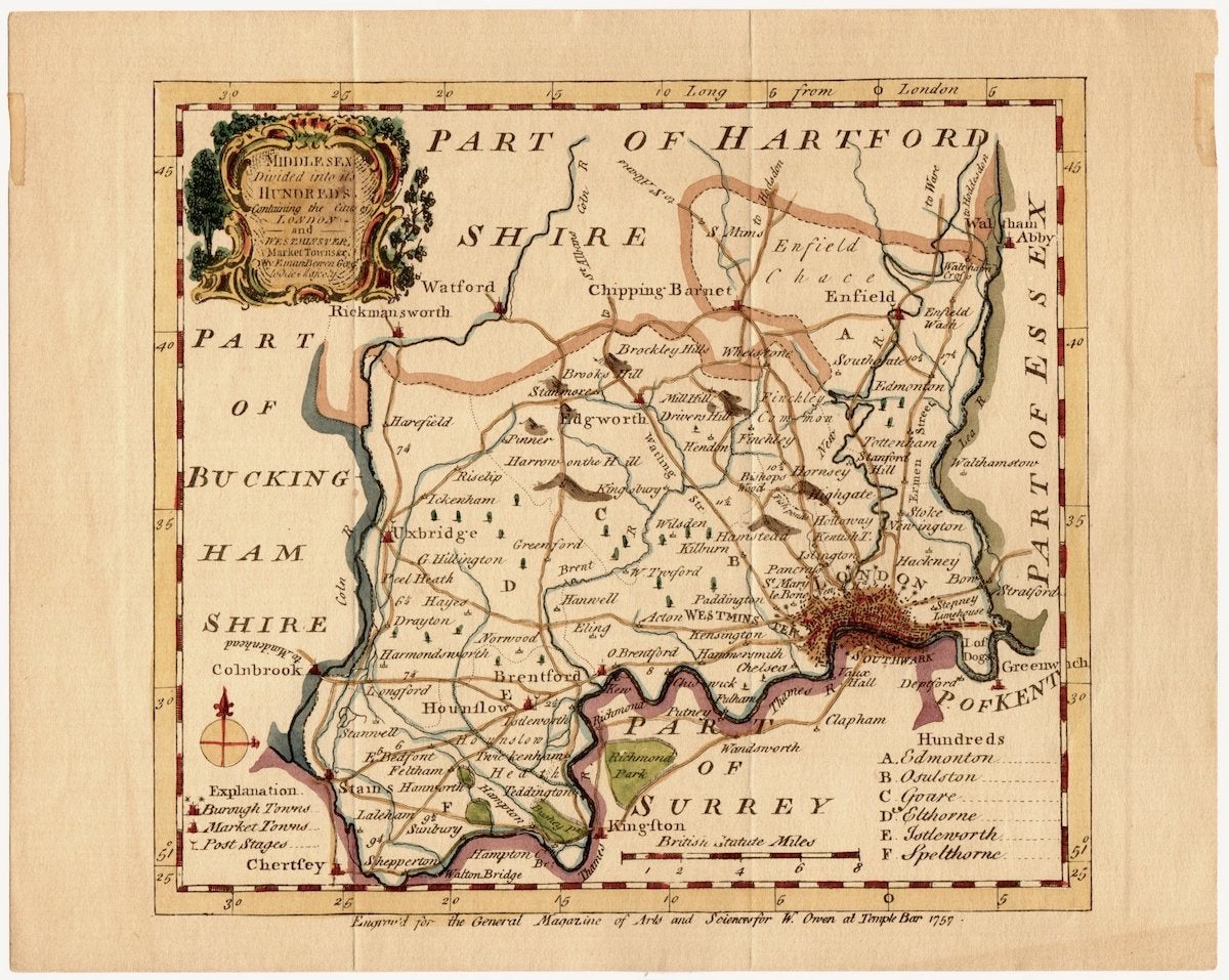
Map of Middesex Including London, UK (1757)
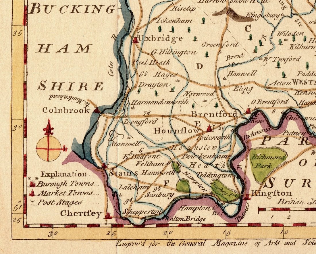
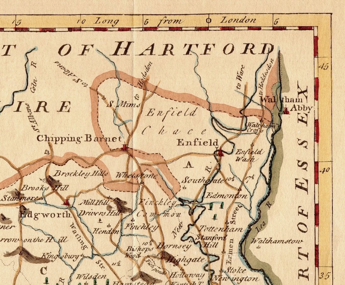
A hand-colored etching of Middlesex by Emanuel Bowen "Divided into its hundreds containing the Cities of London and Westminster, Market Towns..." Emanuel Bowen was a Welsh map engraver, who became the Royal Mapmaker to both King George II of Great Britain and Louis XV of France. Bowen was highly regarded by his contemporaries for producing some of the most detailed and most accurate maps of his era. Item #1466.
Condition: Very Good, one 1.0" x 1/8" piece of tape along left edge; right edge has ghosting of previous tape; folded as issued.
Price: $85.00
See all items in
Antiquarian,
Travel + Maps
See all items by Emanuel Bowen