

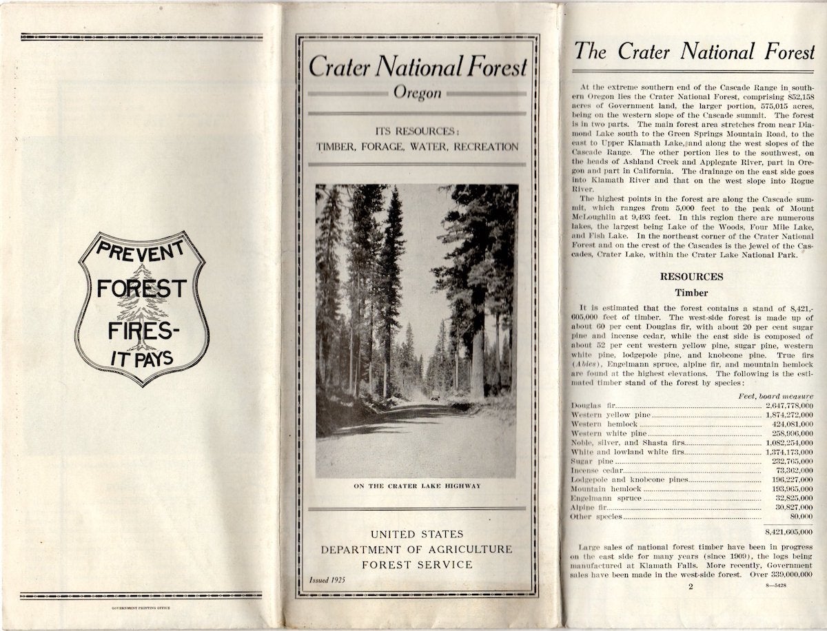
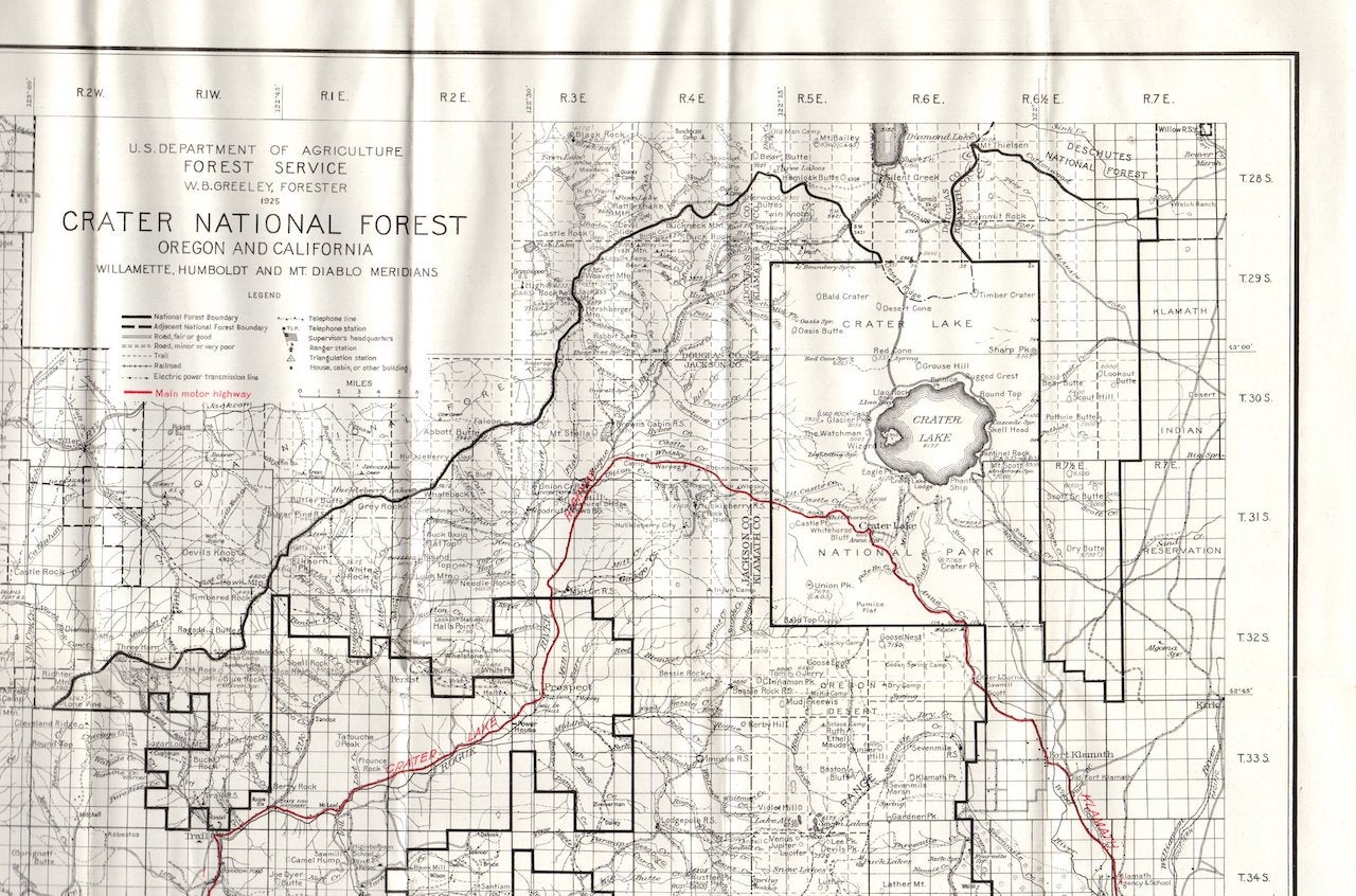
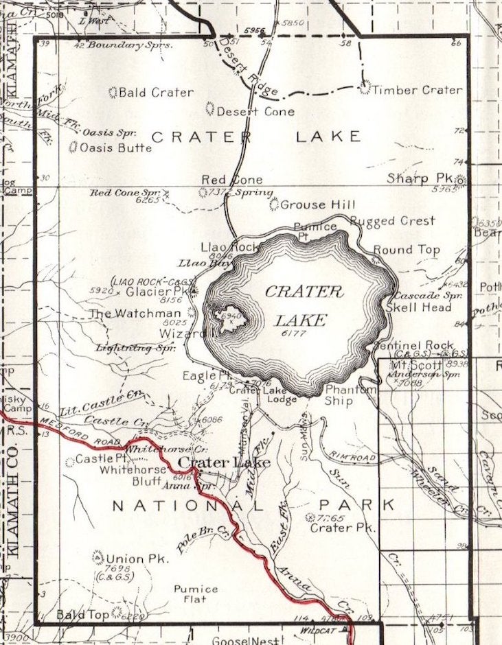
Crater Lake National Forest Map (1925); It's Resources: Timber, Forage, Water, Recreation
A vintage Crater Lake National Forest Map map, issued in 1925 by the U.S. Dept. of Agriculture/Forest Service. Folds out to 24" x 27" with one side having information on recreation for sportsmen and campers, resources, lakes and other points of interest plus a pledge for prevention of fire in the forests. The other side is the map of the Crater Lake National Forest in red and black. This map also available in the 1930 issue date.
Please note: we have several other maps from the Forest Service of this vintage (1920s-1940s) including Washington, Oregon, Mount Baker, Columbia, Snoqualmie, Rainier, and Chelan National Forests (WA), plus Deschutes, Santiam, Willamette, Umpqua, Rogue River and Crater Lake National Forests (OR). Inquire by email. Item #1507.
Condition: Very Good, folded as issued; some toning to paper.
Price: $50.00